North East Link – Melbourne’s Major Infrastructure Project
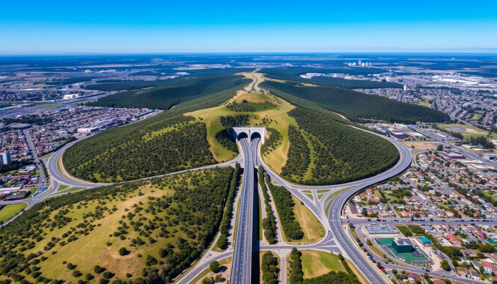
Melbourne’s ambitious North East Link represents the city’s most significant infrastructure undertaking in decades. The 10-kilometre tolled highway will connect the M80 Metropolitan Ring Road at Greensborough to the Eastern Freeway at Bulleen, threading through twin three-lane tunnels beneath Banyule Flats and the Yarra River. When completed, the project will finally seal the orbital ring road network that urban planners have envisioned since the 1920s.
Victoria’s Big Build program has positioned this undertaking at its centrepiece, allocating resources that dwarf any previous road project in the state. The development has attracted both support for its promised traffic relief and scrutiny regarding its environmental footprint and community impact.
North East Link at a Glance: Key Project Statistics
What the North East Link Aims to Deliver
The project targets substantial improvements to Melbourne’s northern road network. Traffic modelling indicates the initiative could remove approximately 15,000 trucks from local roads daily, providing relief to residential streets that currently bear heavy through-traffic burdens.
- Twin three-lane tunnels will add significant capacity to the northern corridor
- Travel times between key points may be reduced by up to 35 minutes
- The Eastern Freeway will be widened to accommodate increased traffic volumes
- A new Yarra River crossing will complement existing infrastructure
- Integrated Doncaster Busway will support public transport options
- Approximately 34 kilometres of walking and cycling paths planned
| Aspect | Details |
|---|---|
| Total Cost | $26 billion |
| Expected Completion | Late 2028 |
| Tunnel Length | 6.5 kilometres (twin bores) |
| Depth Under Yarra River | 40-45 metres |
| Trucks Diverted Daily | 15,000 |
| Maximum Time Savings | 35 minutes |
| Bridges to be Built | 40 structures |
| Walking/Cycling Paths | 34 km |
The Route: From Greensborough to Bulleen
The selected western alignment, designated Route A, traces a path through Melbourne’s northern suburbs before descending into tunnel sections. Beginning at the Greensborough interchange with the M80, the route passes through Watsonia and Rosanna, emerging to connect with the Eastern Freeway at Bulleen Road.
Tunnel Sections and Engineering Challenges
Tunnelling extends from Lower Plenty Road through to the Eastern Freeway, with the critical section passing 40 to 45 metres beneath the Yarra River bed. Engineers extended the underground portion by 1.9 kilometres compared to earlier proposals, opting for additional tunnelling to minimise surface disruption to sensitive environmental areas.
Tunnel boring machines commenced operations in mid-2024, advancing the project toward its scheduled completion. The extended tunnel alignment protects Banyule Flats and surrounding parklands from surface-level construction impacts.
Surface Infrastructure and Interchanges
Above ground, the project includes significant urban design elements. Greensborough Road will feature a tree-lined boulevard, while a green bridge will carry pedestrians and cyclists over the main carriageway. Key interchanges include connections to the M80 (serving Seymour and Melbourne Airport routes), the Greensborough Bypass on State Route 46, and Grimshaw Street via a single-point urban interchange design.
Why Alternative Routes Were Set Aside
Planning documents from 2008 evaluated several corridor options before recommending the western alignment. A central route would have passed through Eltham and Warrandyte toward EastLink, while an eastern option proposed alignment through Kangaroo Ground and Chirnside Park. According to the technical analysis by GHD, budget constraints and engineering feasibility assessments favoured the selected western tunnel corridor.
Timeline: From Announcement to Opening
The North East Link has progressed through distinct phases since its initial announcement. The Victorian Government first pledged support in 2016, with early cost estimates of $10 billion. The project subsequently moved through planning approvals, environmental assessment, and procurement stages before breaking ground.
Construction Phases and Current Progress
Early works commenced in 2020, establishing site compounds, relocating utilities, and conducting geotechnical investigations. Major tunnelling operations began in mid-2024 with tunnel boring machines now operating along the alignment.
Construction continues across multiple fronts as of the latest available information. Design work progresses for park facilities including Ford Park and Binnak Park, while utility relocation and ground preparation advance throughout the corridor.
The project encompasses not only the central highway corridor but also substantial upgrades to connecting infrastructure. The Eastern Freeway will be widened to 20 lanes in sections, the M80 Ring Road receives enhancements, and the Doncaster Busway integrates public transport options. Approximately 25 kilometres of walking and cycling paths form part of the overall scope.
Project Benefits and Economic Impact
Proponents argue the North East Link will deliver meaningful improvements to Melbourne’s transport network. The primary benefits centre on reduced congestion and improved freight efficiency across the northern region.
Capacity and Connectivity Improvements
The twin three-lane tunnels will accommodate substantial traffic volumes, complementing smart motorway technology throughout the corridor. Park-and-ride facilities, including a $69 million development at Bulleen, aim to encourage modal shift for commuters travelling toward the CBD.
Freight operators stand to benefit significantly from the new connection. The ability to bypass local roads removes heavy vehicles from residential neighbourhoods while providing a more efficient route for commercial traffic moving between eastern and western Victoria.
The concept of completing Melbourne’s orbital ring road dates to 1929 planning documents. The North East Link finally addresses what has been characterised as the “missing link” in the city’s freeway network, though the project has evolved considerably from its earliest conceptualisations.
Chronological Project Milestones
- 2016 — Victorian Labor Government announces North East Link with initial $10 billion cost estimate
- 2018 — Planning and environmental assessment processes commence
- 2020 — Early works begin across the project corridor
- 2022 — Environmental Effects Statement assessment finalised
- 2023 — Major construction contracts awarded; site preparation intensifies
- Mid-2024 — Tunnel boring machines begin excavation
- Late 2028 — Projected opening date for all components
What We Know and What Remains Unclear
| Established Information | Information Requiring Clarification |
|---|---|
| Total project cost: $26 billion | Specific tolling arrangements and pricing structure |
| Opening scheduled for late 2028 | Final scope of some ancillary facilities |
| Twin 6.5 km tunnels confirmed | Detailed traffic modelling outcomes |
| Tunnelling commenced mid-2024 | Long-term maintenance arrangements |
| M80 to Eastern Freeway alignment fixed | Specific timeline for parkland restoration |
| Public-private partnership structure | Ongoing operational funding mechanisms |
Community and Environmental Considerations
The North East Link traverses environmentally sensitive areas, prompting careful attention to minimising surface impacts. Tunnel depths of up to 40 metres beneath the Yarra River protect batters and surrounding ecosystems from construction disturbances. The project incorporates noise walls along substantial portions of the alignment and includes wetland restoration components.
Community engagement has occurred throughout the planning process, with the project team maintaining information channels through northeastlink.vic.gov.au. The Urban Design and Landscape Plan outlines proposed parklands extending from Watsonia through to Bulleen, with particular emphasis on recreational spaces adjacent to the Yarra River corridor.
Technical Advisory Perspective
Engineering consultancy GHD has supported the project through reference design, environmental effects assessment, and approvals processes. Their work has examined engineering feasibility, contamination investigations, and urban design integration across the corridor.
Looking Ahead: What Comes Next
With tunnelling now underway, attention shifts to the complex underground works that will consume the coming years. The Yarra River crossing presents particular engineering challenges given the depth and ground conditions involved. Surface works will continue concurrently, with bridge construction, interchange completion, and landscaping progressing throughout the corridor.
The Doncaster Busway component remains an integral part of the overall project scope, designed to provide public transport options that complement the new road capacity. Monitoring of construction progress will continue as the project moves toward its 2028 completion target.
When is the North East Link scheduled to open?
The North East Link is expected to open in late 2028, though project timelines remain subject to review as construction progresses.
How much does the North East Link cost?
The current estimated cost stands at $26 billion, representing Victoria’s most expensive road project. Initial announcements in 2016 placed estimates at $10 billion.
What route does the North East Link follow?
The western alignment connects the M80 at Greensborough through Watsonia and Rosanna to the Eastern Freeway at Bulleen, with 6.5 kilometres running through twin tunnels beneath Banyule Flats and the Yarra River.
How long are the North East Link tunnels?
The twin tunnel sections span 6.5 kilometres, running between Lower Plenty Road and the Eastern Freeway. Tunnel depths reach 40-45 metres below the Yarra River.
What benefits will the North East Link provide?
Expected benefits include removal of 15,000 trucks from local roads daily, travel time reductions of up to 35 minutes, and completion of Melbourne’s orbital ring road network.
Are there alternatives to the selected route?
Planning documents from 2008 evaluated a central route through Eltham and Warrandyte, plus an eastern option via Kangaroo Ground and Chirnside Park. Budget and engineering factors led to selection of the western tunnel corridor.
How is the North East Link being funded?
The project operates as a public-private partnership under the Primary Package Tunnel arrangement. Detailed funding mechanisms and tolling arrangements have not been fully disclosed in available public documentation.
What environmental protections are included?
The tunnel alignment protects sensitive surface areas including Banyule Flats. The design incorporates noise walls, wetland restoration, and green bridges. Tunnel depths reaching 40 metres minimise ground disturbance to environmental zones.
More related posts
 Tyrese Proctor: NBA Career, Contract, and Stats | 2025-26
 Josh Hutcherson: Height, Girlfriend, and LGBTQ Speculation Explained
 Suman Mokhtarian: UFC Fighter Shot Dead in Sydney Attack
 Energy Australia App – Features, Setup and Usage Guide
 Canvas Tote Bag Ireland: Where to Buy, Prices & Tips
 John Oliver: Net Worth, Political Bias, and Last Week Tonight Facts
 DJ Khaled: Ethnicity, Net Worth, and Career Timeline
 Grey’s Anatomy Season 22: Renewal Status & Premiere Date
